


A truly remarkable 1772 map of North America by Robert de Vaugondy. Based upon an earlier map of the region by Thomas Engel, this is a fascinating examination of the general layout and waterways of North America - especially in the west. Curiously does not specifically show a Northwest Passage, but leaves clear the possibility that one such passage may indeed exist. Rivers and lakes extending from the eastern part of the continent almost, but never quite meet their counterparts from the west. While the east is displayed with reasonable accuracy, the cartography of the western part of North America is almost entirely conjectural and based upon early reports from Jesuit missionaries. Six largely mythical river systems extend inland from the Pacific or, as it appears on this map, "Mer du Sud". Several meet with enormous and interesting mythical lakes. The northern most of these is Lake Conibas, the center of a supposed lake region that first appeared in Mercator's 1569 map of America. Mercator's version of Conibas been loosely interpreted, depending upon the source, as the Northwest Passage, the Hudson Bay, or the first map of the Great Lakes. Vaugondy situates this region is further west, making it the source of several river systems and a potential station in a "northwest passage". Anian presupposed the existence of a Northwest Passage and, as such, was entirely mythical, though the lands that are now Alaska long bore that name. Further south we find "Grand Quivira" referencing one of the many mythical Kingdoms of Gold. All in all, an extremely attractive and important late 18th century mapping of North America. This map is part of the 10 map series prepared by Vaugondy for the Supplement to Diderot's Encyclopédie , of which this is plate 1. This seminal map series, exploring the mapping of North American and specifically the Northwest Passage was one of the first studies in comparative cartography.
Wow Factor
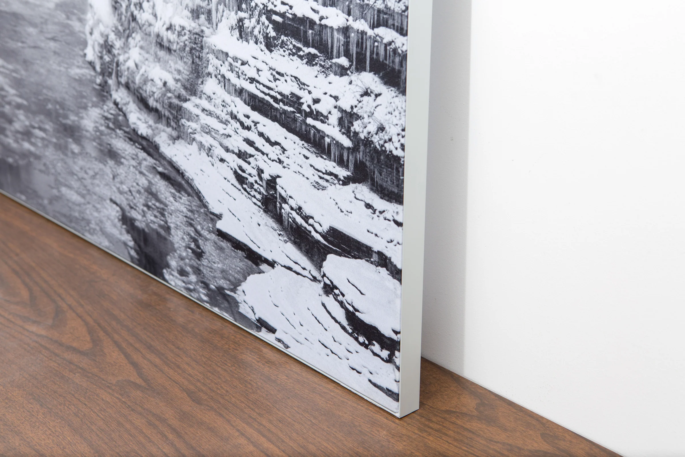
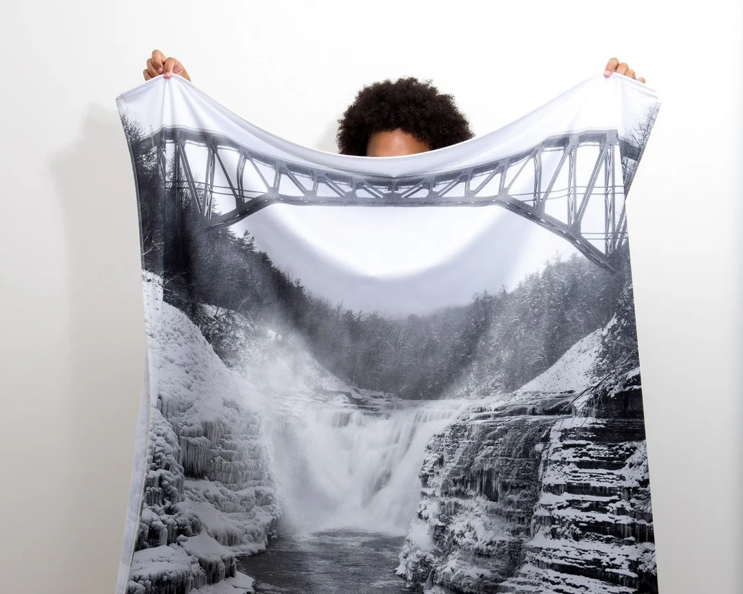
The image is printed on a durable fabric, which is stretched inside a slim aluminum frame. It’s transportable, interchangeable, and easy to assemble. Our infinity frame pieces for large sized prints will lend a “wow” factor to your space.
The colors in our fabric prints are crisp and true to life, with a matte, glare-free finish. With our printing process, the colors permeate the fabric, rather than settling on top, which reduces the risk of scratching or fading. Your art will last a long time!
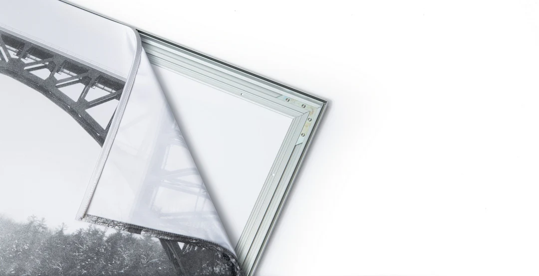
Assemble the frame in minutes, insert the fabric print into the grooves, and your art is ready to hang!

Easy and modern way to display large art in your home or office


