


North Western and MichiganTerritories. Drawn and Published by F. Lucas Jr., Baltimore. B.T. Welch. (1822) | A General Atlas, Of All The Known Countries In The World. Baltimore: Published by Fielding Lucas, Junr. No. 138, Market Street ... | This is a very unusual Lucas atlas - according to Foster, only two copies are known. The engraved title page shows a globe and books on a table, with pages open listing Lucas' products: "Drawing Materials of every kind, Paper of all sizes, Mathematical Instruments, Globes, Maps, and Atlases of every description suitable for Colleges and Schools constantly for sale by the Publisher." It has 31 of the Tanner and Harrison engraved maps of the continents and foreign countries that appeared in the (1815) and (1816) "New And Elegant General Atlas" (only Netherlands bears Lucas' imprint, engraved by Young & Delleker, and is basically the same as the map that appears in the 1823 "General Atlas Containing Distinct Maps..." ). Of the remaining 36 maps, 8 are of South America and the West Indies and are unchanged in the 1823 atlas; the other 28 maps are in many cases early states of the new U.S. maps that appear in the 1823 atlas and replace the Tanner engraved U.S. maps of 1815 and 1816 atlases. They all have Lucas' imprint and show various engravers, Welch, Young & Delker, Cone & Freeman, Kneass, and Hufty. Compared to the early 1823 atlas (our #4584), 16 of the 28 U.S. maps are earlier issues, with only one being a later issue - New Hampshire shows Merrimack County (1823) which does not appear on the early 1823 atlas map (this was probably drawn in anticipation of creation).
Wow Factor
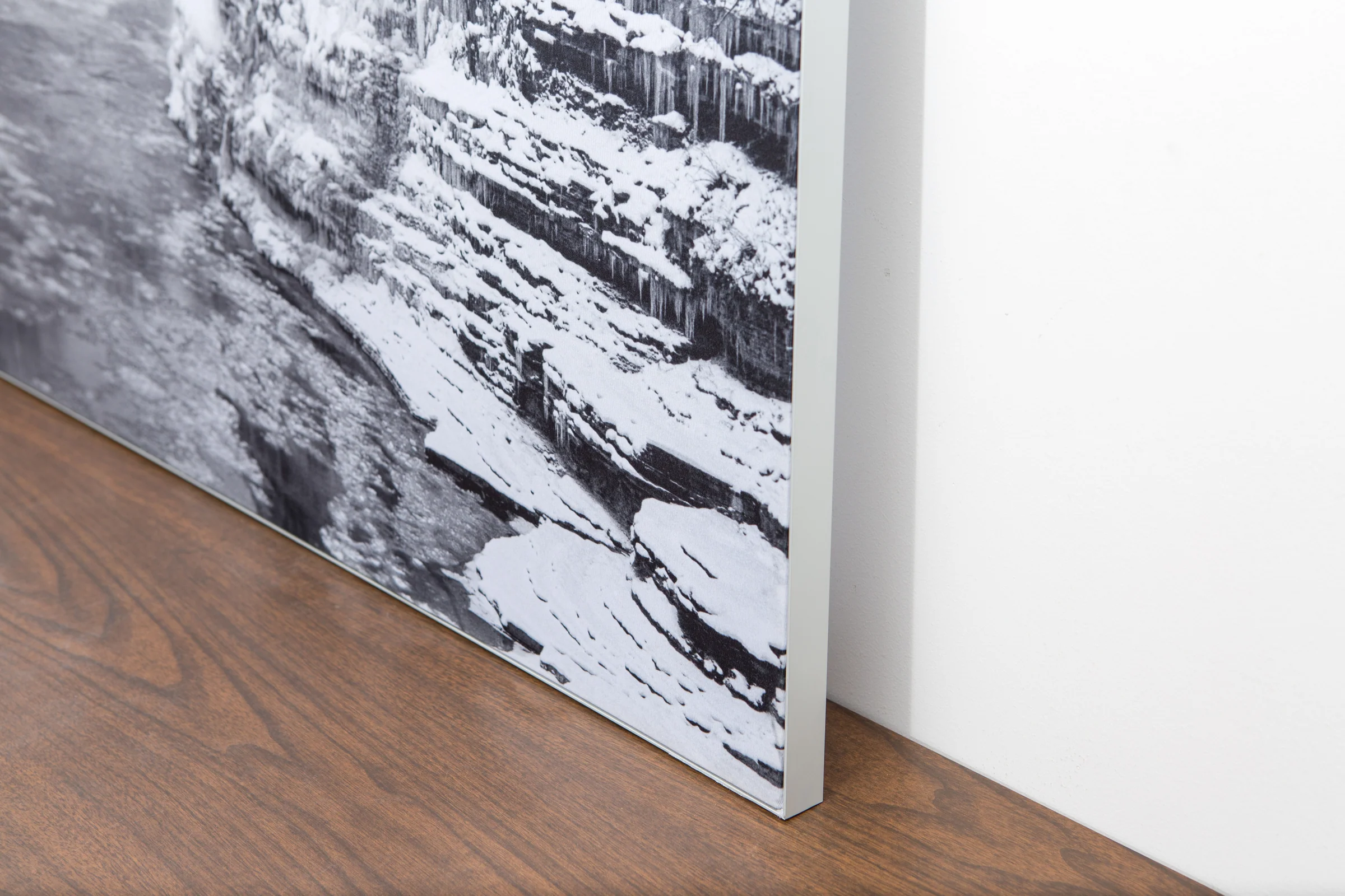
The image is printed on a durable fabric, which is stretched inside a slim aluminum frame. It’s transportable, interchangeable, and easy to assemble. Our infinity frame pieces for large sized prints will lend a “wow” factor to your space.
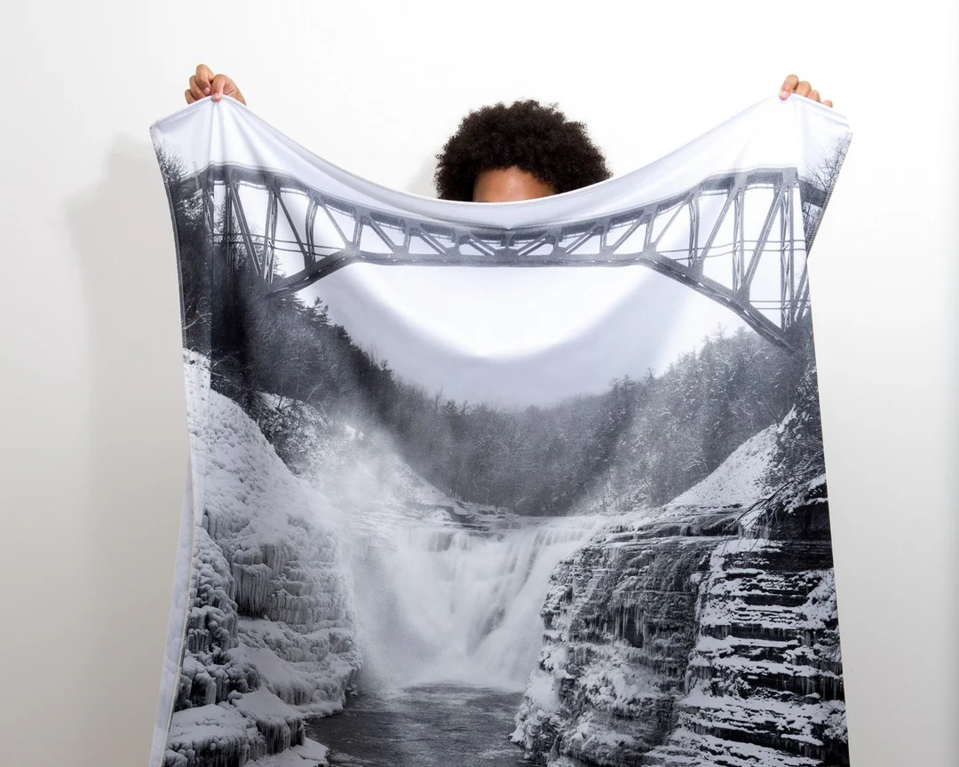
The colors in our fabric prints are crisp and true to life, with a matte, glare-free finish. With our printing process, the colors permeate the fabric, rather than settling on top, which reduces the risk of scratching or fading. Your art will last a long time!
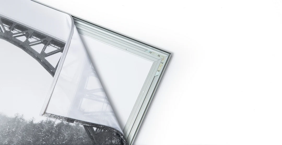
Assemble the frame in minutes, insert the fabric print into the grooves, and your art is ready to hang!

Easy and modern way to display large art in your home or office


