


This is a beautiful example of Alexandre Delamarche's 1850 map of the ancient world, including Asia, europe and Africa. The map shows the world of antiquity from the Atlantic Ocean to Burma in Asia and from the Indian Ocean to the North Sea. It includes all of europe, Arabia, parts of Asia including the Indian Subcontinent, and the northern part of Africa. The extent of ancient geographical knowledge is identified by a green line running just south of Scandinavia, across northern europe, then southeast, skirting the southwestern border of China, but embracing India, Burma, and Siam, though not Malay, then laterally bisecting the Indian Ocean and running northwest just south of the Sahara to meet the Atlantic in Morocco. A more contemporary geography in ghosted in beyond the green line to give readers better context. Throughout, the map identifies various cities, towns, rivers, mountain passes and an assortment of additional topographical details. Political and regional borders are highlighted in outline color. This map was issued by Delamarche as plate no. 5 in his Atlas Delamarche Geographie Modern.
Wow Factor
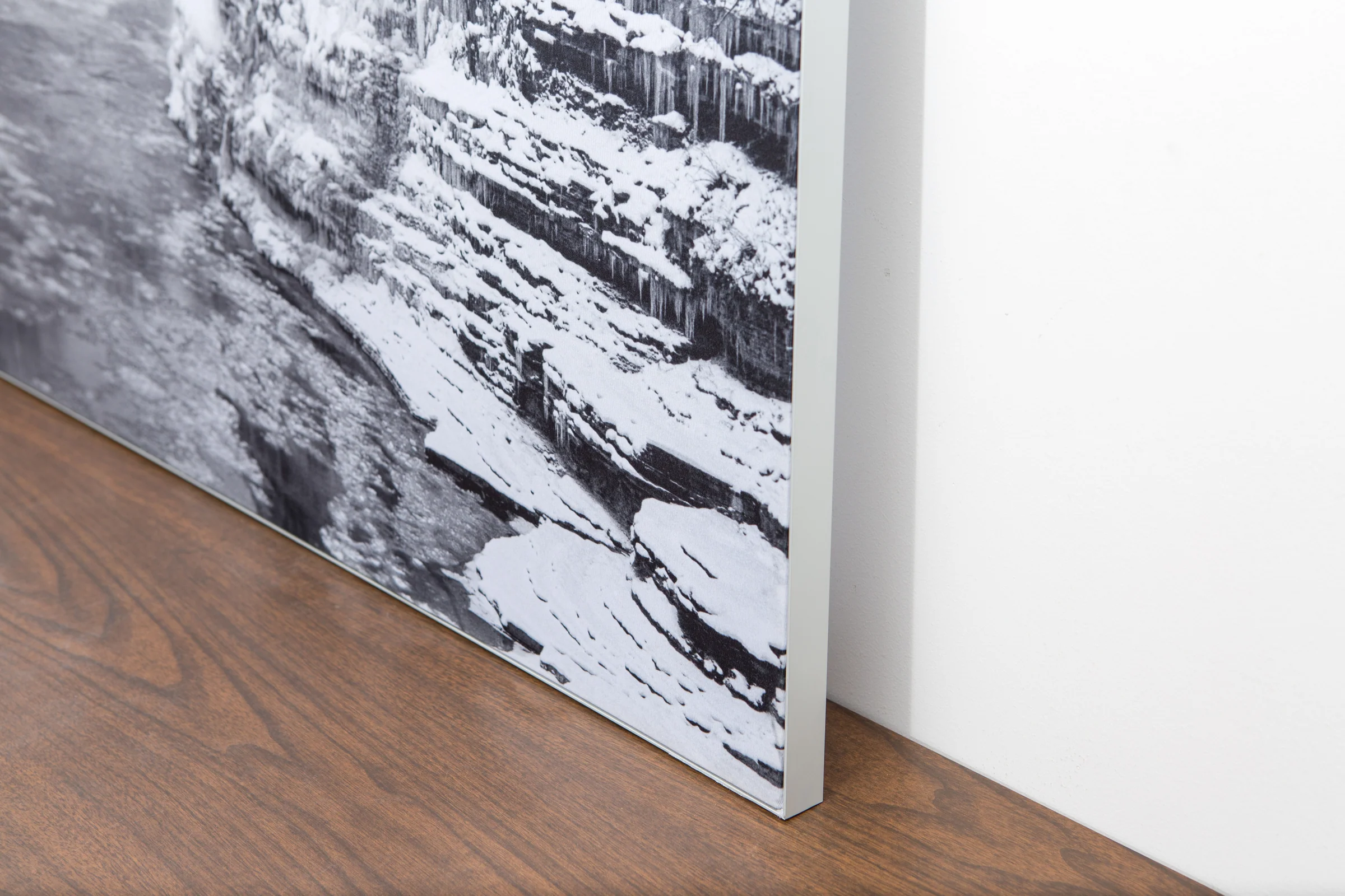
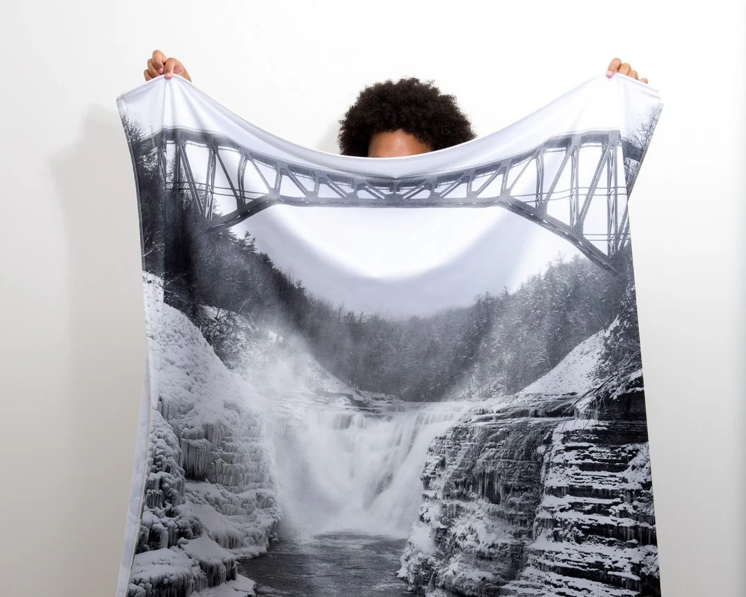
The image is printed on a durable fabric, which is stretched inside a slim aluminum frame. It’s transportable, interchangeable, and easy to assemble. Our infinity frame pieces for large sized prints will lend a “wow” factor to your space.
The colors in our fabric prints are crisp and true to life, with a matte, glare-free finish. With our printing process, the colors permeate the fabric, rather than settling on top, which reduces the risk of scratching or fading. Your art will last a long time!
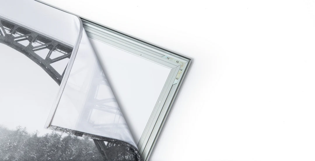
Assemble the frame in minutes, insert the fabric print into the grooves, and your art is ready to hang!

Easy and modern way to display large art in your home or office


